Eagle Peak
⚲ Mount Rainier National Park, Tatoosh Range, Washington
Download GPX Route | Peakbagger.com | Summit Post | Mountain Forecast


Words by Moose
In the winter, the probability of reaching the summits we set our sights on decreases. Can we drive to the trailhead? How many extra road miles will we have to walk? Will we need to factor in time to break the trail? What’s the avalanche forecast? This makes preparing for a winter excursion more time-consuming with fewer options to choose from. Previous weekends’ avalanche forecasts kept us indoors or at lower elevations. So this weekend, we looked for an objective that would get us into some fun terrain while still staying safe. Eagle & Chutla Peaks have been on the list for some time, and the sunny conditions and low avalanche danger made the two Rainier summits a good choice.

As we passed the familiar Whittaker Store & Cafe around 8:30 am, we expected to see lines of cars backed up to get into Mt. Rainier. We were pleasantly surprised to drive right in without much delay. We snuck past the folks waiting for the Paradise gate to open at 9 am and turned right into Longmire. Passing the crowds of families strapping on their snowshoes and attaching their sleds to their backs, we drove over the bridge to our own private parking spot feet from the Eagle Peak trailhead.
As usual, we reluctantly strapped all three pairs of traction gear to our packs and headed up the snow-free trail. Due to the warm weather and rainy conditions the previous week, there was less snow than we’d expected on the first few miles of the trail. Gradually climbing up moderately sloped switchbacks, we eventually reached the icy patches on the trail, and after carefully moving past them for a few minutes, we agreed to stop and put on microspikes to speed us up.
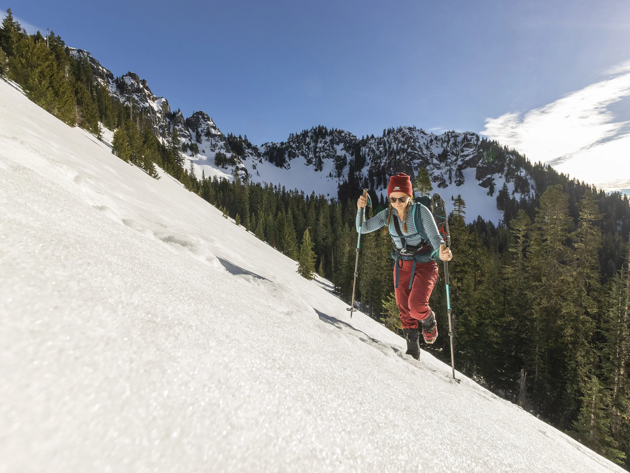
Moose travels across the first open slope at 5,000’
We made quick work through the lower section of the trail to the first exposed and steep section, just below the saddle of Eagle and Chutla Peak. Weary of the avalanche debris further ahead, we stayed on the path the earlier hikers had traveled, heading straight up the left of the basin. It was steep enough to convince us to take a minute to switch over to crampons and ice axes before making the ascent. A few post holes and veggie belays later, we made it to the saddle. While snowshoes were not necessary, we’d still recommend them if you embark on this trip when fresh snow has fallen. There were times when they would have been helpful but not worth the time to transition.

Moose ascends the slope up to the saddle of Eagle and Chutla Peaks at 5,600‘
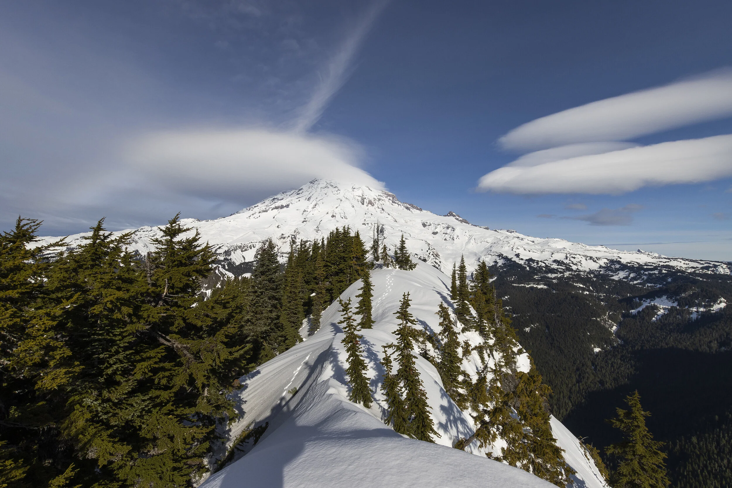
In the rare blue winter sky, we quickly came to realize that many of the surrounding volcanoes were visible in the distance; we enjoyed great views of Mount Adams, Mt. St. Helens, and Mount Hood. Grateful for the sunny warm day and our first good views in months, we headed up the final steep section up to the summit block.

After leaving the saddle, hikers face some light exposure while traversing a short slope to get to the base of Eagle Peak.
Here at the base of the summit block, we met a hiker waiting for her partner to rappel from the rock ahead of us. What we thought would be a simple class 2 scramble ended up being more of a rock climb up about 35 feet of steep rock. Collin quickly removed his crampons to attempt the feature ahead, while I opted to stay behind, unsure of my ability to safely descend from the summit.


Words by TETON
Once I got up the steep headwall, I headed to what I thought was the summit. From this vantage point, I could see that the true summit was still a bit further up the ridge. I replaced my crampons, which I had removed for the steep climbing, and began to navigate the ridge. I was required to drop low a couple of times before regaining the ridge and summiting the true mountain top, the snow was sound so even the scariest bits seemed reasonable to attempt. Once I got to the top, I enjoyed a grand view of Mount Rainier which at this point had gathered enough clouds to obstruct the true summit. I stayed on top for only a moment before retracing my path through the snow back along the ridge and down to the steep headwall. I downclimbed the wall with help from Moose who eyed footholds while I carefully retraced my route. Once on the ground, I was extremely happy to have pulled off the climb. It was an exciting feat that pushed my comfort zone - precisely what I had signed up for.
The true summit of Eagle Peak in front of Mount Rainier from the false summit of Eagle Peak - looking back on my tracks from the true summit.

Brief summit ridge, looking back from the summit, Mount Adams seen in the distance (left)

Teton down climbs the scramble

Moose at the base of the summit block scramble
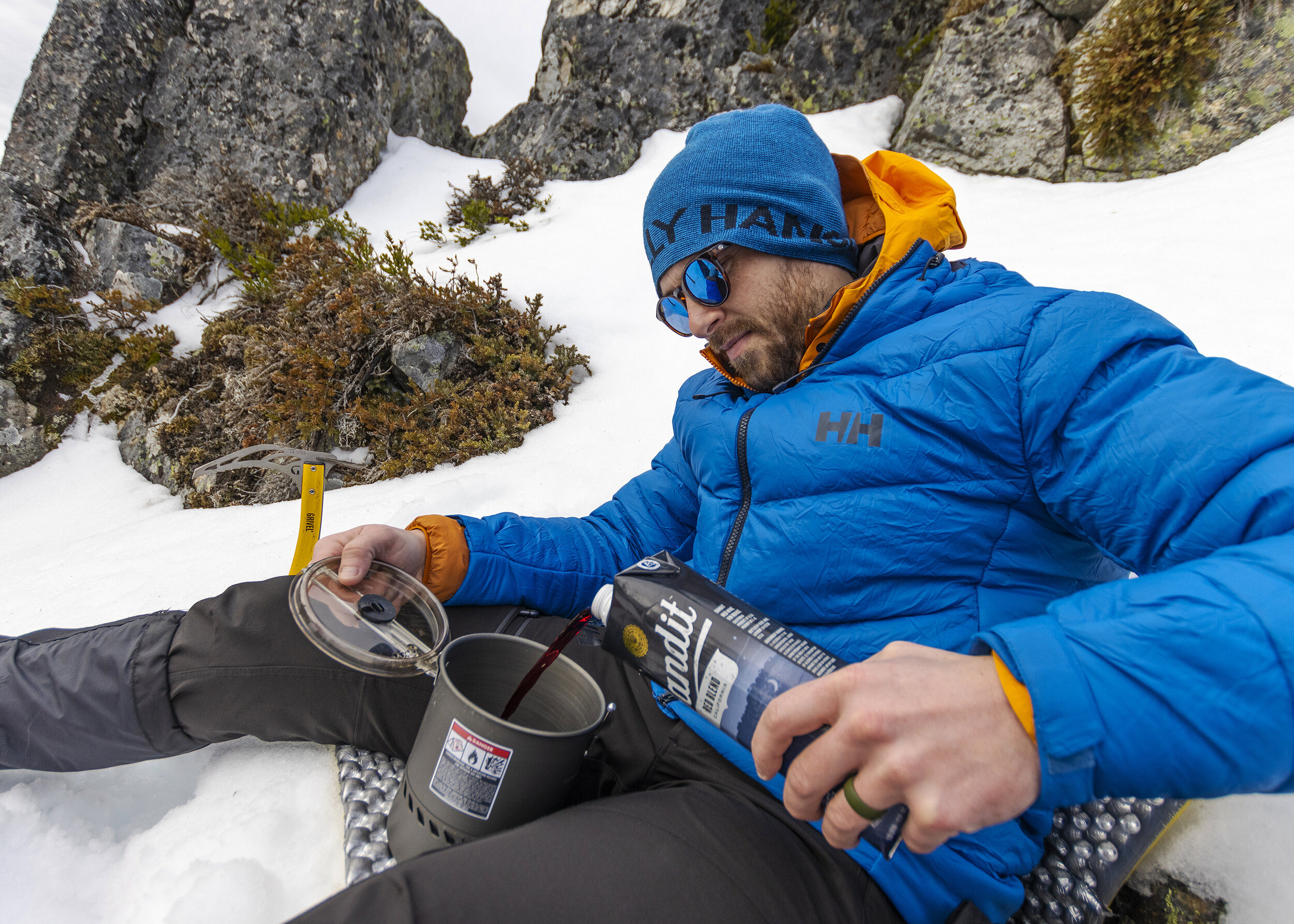
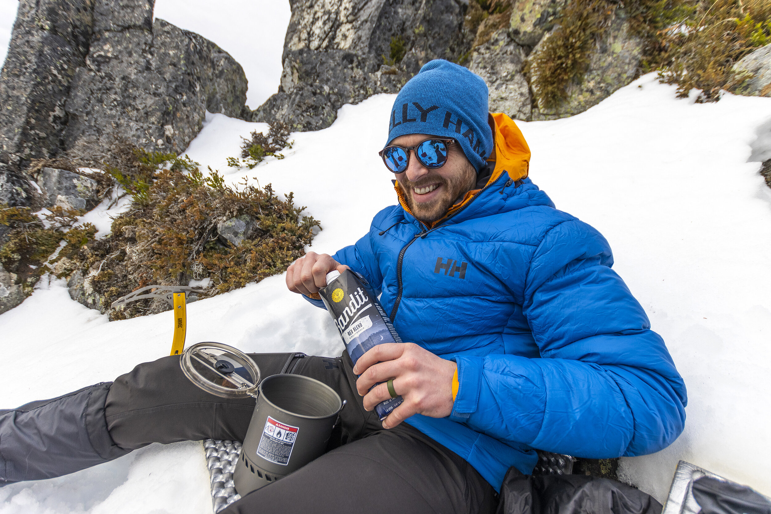
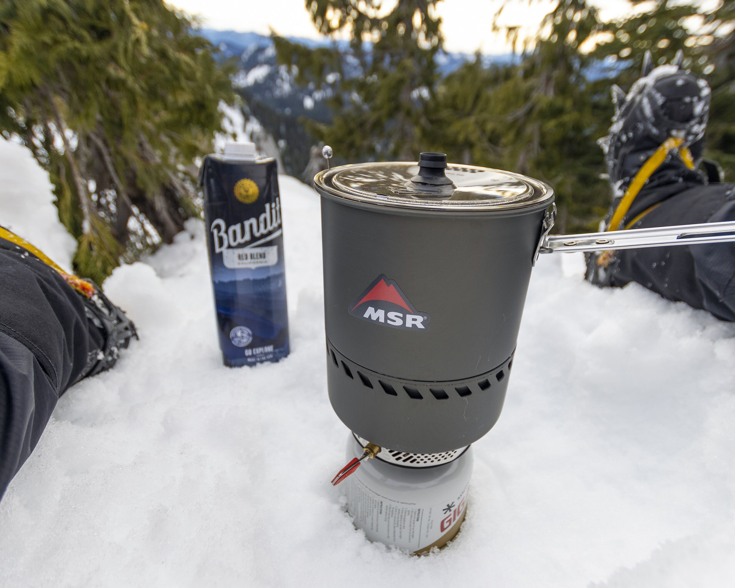
Once we reunited, we decided to head back to the saddle to enjoy our lunch. We quickly dug out our picnic area and used our Therm-A-Rest for cozy dry seats in the snow. To stay warm while we were idle, we heated up some Bandit wine to pair with our store-bought sandwiches. Luxury.

Words by Moose
Another winter struggle is the little daylight available to attempt a long day hike. With the sun already setting, we knew realistically we didn’t have the time to conquer Chutla peak. We could see the route as we descended Eagle and it didn’t look like anyone had attempted it recently. Nonetheless, we decided we couldn’t give up on Chutla without first giving it a try.

Looking back on Eagle Peak from the Eagle Peak/Chutla Peak saddle

Chutla Peak upper left, Wahpenayo Peak center left, Mount Adams in the background

Moose begins her way along the saddle ridge - Eagle Peak seen in the background

Making our way up towards Chutla Peak
We post holed our way up the snowy ridge, assessing the snowbanks and cornices that had formed and using the trees as veggie belays as security in case the fictitious snow “ground” fell below us. Eventually, the terrain became steeper and more ominous than we would have liked to embark on as the sun was setting behind us, so we opted to forfeit and head back down.

After climbing up the ridge towards Chutla we decide to count our losses and head back to minimize our night hiking.

The daytime sun had warmed the snow, causing us to fall in thigh-deep as we descended. So, instead of falling in each step, we joyfully glissaded much of the way down to the treeline. From there, it was smooth sailing back to the Nisqually River where our car awaited us. The sun set behind the snowy mass of Mount Rainier as we traded our snowy boots for crocs and changed into our clean and dry car clothes.

While disappointed that we didn’t conquer both objectives, the Tatoosh Range is one we’ll be back to in the future. It was a great day to be outside and we couldn’t have asked for better weather. Not to mention, any day spent in a National Park is a good day!

We finished this trip off with a pan of homemade nachos once we got back home.
Practice good trail etiquette, LIKE, SHARE, and COMMENT! ✌️❤️🏔